This is an on-line version of the Downton Heritage Trail booklet, originally published in 2009, which gives the visitor a
brief introduction to most of Downton. At the points of interest shown on the map there are plaques and some notices
giving a short description of the sites.
Please note that as the book was published in 2009, there are inevitably several changes to be incorporated -
the authors are currently reviewing it and the changes will be included shortly. Unofficial updates are shown in red.
On selecting a page below, it will open immediately beneath. To close the page, click the title again.
Additional information about Downton is in the "Beyond The Trail" section.
In the pages there are several underlined words - clicking/tapping these words will open another window showing more detail.
To return to the main pages, just close this window.
The land around Downton has been inhabited for more than 6,000 years. There is evidence of this in many places both within
the village and the surrounding downs.
In the 1950s evidence of Roman occupation in the area was found when the large mosaic floor of a villa was unearthed off
Moot lane. Further digging revealed seventeen rooms, a bathhouse and corn-drying furnace (more on this can be found under
Plaque 13).
An Anglo-Saxon Charter of 672 AD names the village as Dunton, meaning ‘the village by the hill’, and through various
spellings over time: Duntune, Duntone, Duneton and Donton, eventually came the name of Downton. The early inhabitants
lived in the High Street area, close to the church.
The Domesday book of 1086 records that the parish of Downton was held by the Bishop of Winchester and comprised 97 hides
of land, 2 mills and about 400 to 500 inhabitants.
An 1137 reference can be found to a castle being built near the river, mosst probably on land that is today known as
The Moot, in the vicinity of Castle Meadow or the ‘island’ behind the mills.
In 1208 the Bishop of Winchester, Peter des Roches, obtained permission to build a new borough and market, to provide
extra and easily collected revenue. This gave the shape to the village until significant twentieth century expansion.
The population of 1350 recorded in 1931 had more than doubled by 1991 to 2800, with houses built along Moot Lane and
in the area beyond the A338 towards Wick Down. The 2011 Census records 3,073 residents in the parish of Downton – the majority
being in Downton village, which had shown a 22% growth since 2001.
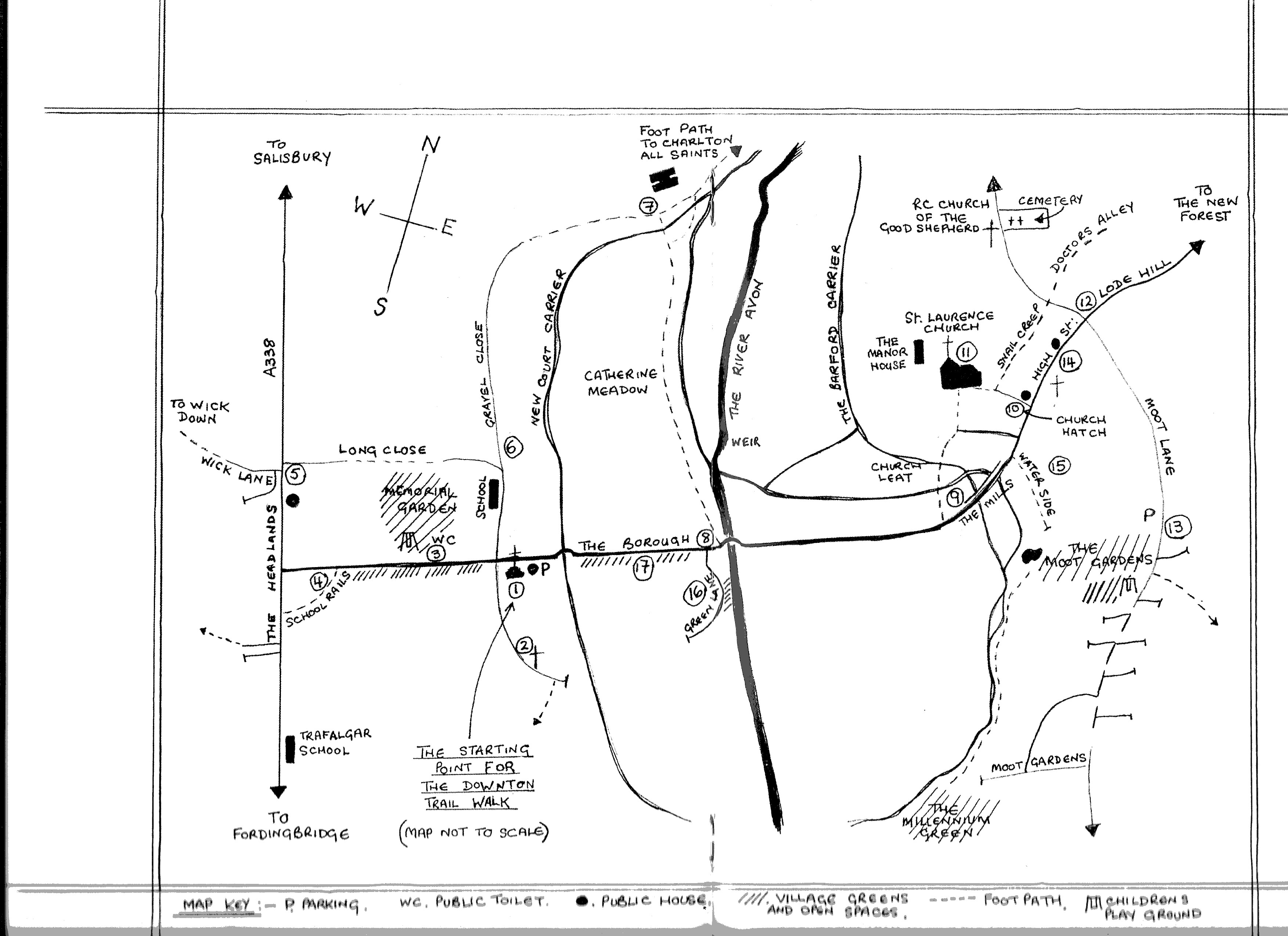
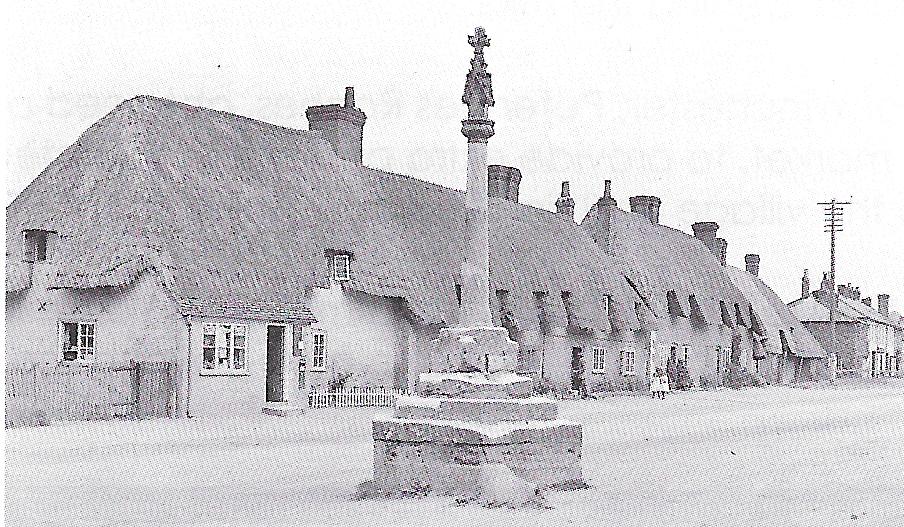
The Heritage Trail notionally starts at the information board outside The Goat
(previously called "The White Horse"), in front of The Borough Cross. Obviously the Trail can be "started" at any point
indicated below, but for consistency with Plaque numbers, we'll stick with The Goat! the Borough Cross - an ancient
and somewhat battered monument - may date from around 1208, when Bishop Peter des Roches founded The Borough. In 1642 the
cross was damaged by Cromwell’s troops. In 1797 the cross was repaired by the village Burgesses, who recorded the event
and their names on the first step:VETUSTATE COLLAPSUM Ed BOUVERIE COM. FIL ET.GUL. SCOTT. Ed BURGENS ADPARL. FUNDITUS
FIRMARI F AD 1797.
The Cross was again restored as part of the Millenium??? and a plaque to the memory of Queen Elizabeth was added.
During the 18th century a weather vane was placed at the top of the cross and at the time of Queen Victoria’s Diamond
Jubilee in 1897 it was repaired again at the expense of Lady Radnor. There was also once a street light attached to the
cross, which illuminated the area, known as The Square and used as a market place.
The cross was damaged in 1940, when a German land mine exploded in the nearby water meadows. To celebrate the Coronation
of Queen Elizabeth II in 1952 a further inscription was added. At the same time, work was done to replace the upper cross
section, which had been found buried in the garden of nearby Fairfield House. It is possible that this is the original
cross, knocked off during the time of the Commonwealth.
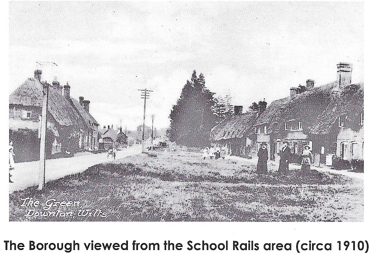
The cross (shown above circa 1910) has always been a gathering point in the village. When Parliamentary elections were
held in the village, Downton having had the right since the 14th century to send two Members to Parliament, the
announcements of the successful candidates were proclaimed here. Bobby Shafto, immortalised in the song “Bobby Shafto
went to sea, silver buckles at his knee” was a real person, and represented Downton as MP from 1779 to 1790.
Leaving The Cross and turning into South Lane, next to The Goat, the Trail passes the Court House, known in some
records as The Borough Manor.
In 1679 Gyles Eyre was granted permission to open a Grammar Free School here for 12 boys. He was also given permission
to hold two fairs in The Borough, one on the 12th of April and the other on The feast of St. Matthew; all profits from the
fairs were to go to the school. The school finally closed after the new Board School opened in The Borough (see Plaque 3).
This was also where The Parliamentary candidates were chosen and where the Mayor, whose legal title was that of Alderman,
was elected annually of The Court Leet of The Borough. By 1835 this high sounding position in fact held limited privileges;
the only known duty attached to the office by then was to ‘attend to and regulate the weights and measures within The
Borough’.
In 1714 the MPs had provided the Mayor with a silver mace made by Gabriel Sleath of London, bearing the coats of arms
of the Eyres and Duncombe families,who had represented The Borough in Parliament from 1707 till 1714. However at the
abolition of The Borough the then Mayor, Mr Hobbs, refused to hand over the mace and left the village for Shirley,
where he lived in a house he had named Mace Cottage. Later the mace was discovered in a Southampton pawn shop; hearing
of this, Lord Radnor purchased it for the village and presented it at a ceremony in December 1921. It remained in the
Memorial Hall until 1970 when it was removed to Salisbury and South Wiltshire Museum.
The Heritage Trail plaque is at the entrance to the Downton Baptist Church which was opened for worship on New Year’s
Day 1794. It was built by members of the Baptist congregation when a conflict arose over the Aryan heresy, when those who
were opposed first worshipped in a cottage in South Lane. The original Baptist Chapel, built in 1716 before the split of
the chapel members, was in Gravel Close and is now used as the Downton Band Hall (see Plaque 6). Tradition has it that
during the Protectorate of 1653 to 1658 the Baptists of Downton often worshipped on Wick Downs.
South Lane itself was once an old drove road to Charford. It now ends in a footpath leading on to fields to the south
of the village. this is not part of the trail,so please retrace your steps back to The Borough.
When Bishop Peter des Roches established The Borough he had it laid it out in ‘Burgage’ plots. By the 1230s, 12O
families occupied the houses and workshops, providing the Bishop with an annual income of £10.
Many of the houses in The Borough can still be identified as Burgage plots by the numbers carved in stone blocks
set into the fronts of the houses, usually over the doorways. The numbers were originally painted but the stones were
put in place when Lord Radnor gained control of the Burgages in the late l8th century. Burgages had by this time become
very important as they gave each holder the right to vote in Parliamentary elections. One Burgage number remains painted
rather than in stone(see Plaque 16).
Turning along the south side of The Borough the first house you pass is Fairfield House, once the site of the village
fair ground and, according to folklore, also that of the maypole or whirlygig.
On the green in this area there was also a pound where stray cattle and horses could be kept until claimed by their
owners. Until the introduction of cattle grids at the entrances to the open forest, animals not only strayed from within
the village,but also the New Forest, until the 1960s.
‘The Bunny’ also paases under the Green here. ‘Bunny’ is a local name for a drainage ditch, deriving from
‘bunnell’, an old name for such a ditch. The ditch can still be seen next to the electricity sub-station on this side
of the road and alongside the Memorial Hall opposite.
PLAQUE 3 is at the Memorial Hall. In 1840 Lord Radnor gave this site for the building of a British School in Downton,
for the ‘instruction of boys in the principles of the British and Foreign School Society‘.
The building became the parish hall when the pupils moved in 1896 to the new school built in Gravel Close. Still the
main village hall, it is the venue for many meetings and events, and was named the Memorial Hall when the portico and
plaque to those who died in World War One were dedicated at a service on Easter Sunday, 27 March 1921. More recently the Hall
was extended to give further meeting rooms and to become a children's nursery.
Further plaques were added following the loss of more villagers in World War Two, Korea and the Suez Crisis.
The Memorial Gardens were given to the village by Mrs Emily Bonvalot of
Wick House, in memory of her son 2nd Lieutenant
Edward Bonvalot, who was killed in the First World War. The dedication to him can be seen on the sundial by the main
gates.
Note the cuckoos on the gates to celebrate the Cuckoo Fair held annually in The Borough. The two fairs granted to
Gyles Eyre had died out before the Second World War and a further fair, granted for the eve, day, and morrow of St
Laurence(April 9th to 11th) probably declined with the population in the mid 14th century.
Until the middle of the 20th century Downton held an annual Carnival but support for this waned and it died out. In
1979 ‘the Cuckoo Fair’ was created to raise funds for local charities and groups. The event is held on the Saturday
nearest to the May Day Bank Holiday and attracts 20000 visitors.
Where does the name come from? There are several versions of old stories that probably originate from a time when
folk did not realise the cuckoo was a spring migrant to England. One tale tells of how the bird sinks to the bottom of
the river and stays there until the warm spring weather arrives. Another of how a wise woman of the village would
capture the cuckoo and keep it safe in a cage to over-winter from the cold, before releasing it in spring.
Ancient Spring festivals often centre on a young girl, a May Queen or Princess, and Downton’s Cuckoo Fair has a
Princess. Each year a girl is chosen from the community and on fair day is crowned with a coronet, made in 1991 of
traditional Downton Bobbin Lace.
A little further to the west you will pass the Old Police House, where our own village constable used to live. Next
to this is Long Close Park, the field that was once the home of both the Downton Cricket and Football Clubs.
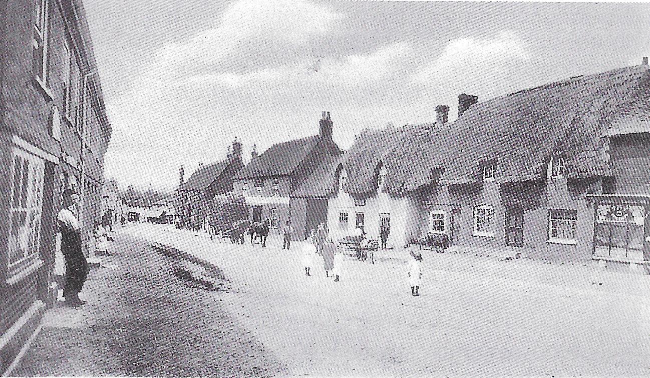
Back on the southern side of The Borough are a number of quintessential thatched cottages, most of which are listed
buildings.
On reaching the southern end of The Borough, with the pretty row of small cottages on your left, you will see Pitt
House to your right. This house is built on what was once the site of a gravel pit in the 18th century. The front door
originally opened directly onto the green but gradually the garden was extended so that now there is only a very small
amount of the first green left beyond its boundary wall.
The Heritage Trail plaque is on a post of what is known locally as ‘School Rails’, across a gravel track leading to
the building at the other side of Pitt House. Once a non-conformist Chapel, and soap boilers premises, then occupied by
Headlands Garage (which has moved to the Industrial Estate), it is now a private house.
In 1847 the building was a British Girls School. On 6 November 1867 adjoining cottages caught fire and were destroyed;
the two room school building was just saved after a wooden shed was torn down to prevent the fire spreading.
Infant children were moved from this school in 1892 to that in South Lane, and in 1896 all the remaining children moved
to the new school in Gravel Close (see Plaque 6). Look closely at the wall as you walk towards the main A338 road and you
will see the marks where the children sharpened their soft slate pencils for writing.
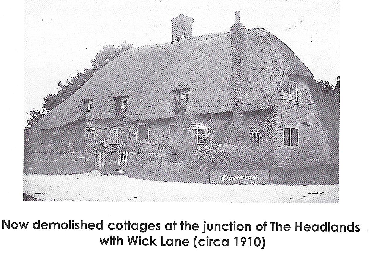
Turning right at the end of the gravel path you reach the Headlands, an area built up in the 18th century. Looking to
your left past the last cottages on the opposite side of the road is an area where the infamous ‘Bully Hag‘, a witch,
is said to have lived.
As you walk past the entrance to The Borough, the ancient grade II listed building of The Bull appears. Recorded as an
inn by 1726, there may in fact have been a building here as early as 1650.
The Bull was a fine coaching inn, perhaps the first on the main Salisbury road. When there was first a railway link
from London to Salisbury a coach departed from here each afternoon to connect with the train at Salisbury.
Interestingly a male trout is also called a bull, and for many decades the pub sign comprised a (bovine) bull stood
in a stream, with a leaping trout added as a clever visual pun. This sign may be seen on the front of the pub facing the main road.
The Bull Hotel has undergone many changes of ownership recently, but under ‘Skipper’ Parker and Peter Scott-Newman was
for many years renowned for its fishing associations. Within a mile of coarse fishing waters on the River Avon, and with
its own fishing rights on part of the river, the hotel attracted anglers from all over the World.
After passing the shops and cottages beyond The Bull, the trail turns right into Long Close West, where you will see the
beginning of the Industrial Estate on the left.
Although no longer the same building, the corner site was once occupied by Downton Engineering. This small rural garage
slowly gained a reputation for the tuning kits it produced, until by the 1960s it had become world famous for its
conversions of racing Minis.
Long Close, known as Duck Lane in the early l9th century, was once mainly a farm complex. By the Second World War it
became known locally as ‘tin town', as an army camp was built on what had been school vegetable gardens.
The Grade II listed Long Close House dates from the mid 17th Century, and has had many additions, most notably the
large glass conservatory on the eastern end of the house. Some cottages on the lane remain but others have been demolished and replaced by newer houses.
Having walked past the rear of the Memorial Gardens into Long Close East, to the junction of Gravel Close, turn right for a short distance
and you will see the Victorian Downton Primary School, built in 1896 as the Downton Board School. As the village has
grown the school has been extended carefully in keeping with the original architecture (other than the most recent building works adjacent to the
Memorial Gardens). Sadly the bell no longer calls
the children to their classes but the ornate domed tower still crowns the building.
Now retrace your steps back past the junction with Long Close East. Gravel Close was part of the old coach road
that crossed The Borough and continued along South Lane, before the A338 was constructed.
In the 19th Century this was a very poor area and had the ironic local name of ‘Belgravia’.
On the right hand side of the road is the old Baptist Chapel. Closed in 1891 this is now the home of the Downton Band.
Band members carry on a delightful tradition of playing carols through the village in the early hours of Christmas
morning, known as ‘the Secret of Christmas'.
When the Band are not using the hall, the old chapel used to ring to the sound of small children singing and laughing at
the local pre-school, which used to be held here daily prior to it's moving to the new building at the rear of the Memorial Hall.
Further along the lane, the house named Barlings stands on what was the entrance to a field where Downton Football
Club once played. Continuing along the footpath on the unmade road past a row of Longford Estate houses, Newcourt
House comes into view.
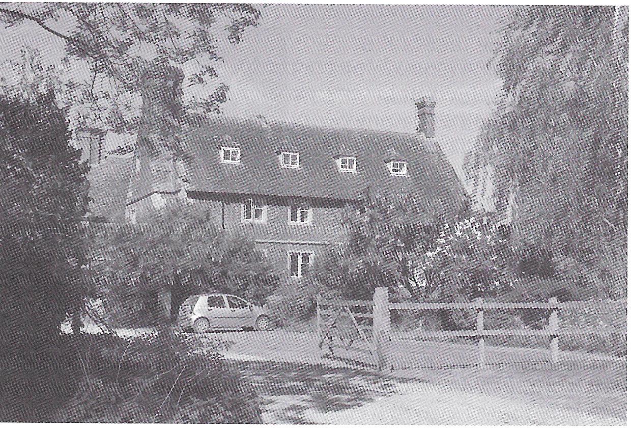
This large Tudor house, built in the form of an ‘H’ in honour of Henry VIII, is part of the Longford Estate. Two
impressive tithe barns were once part of the farm buildings, one sited by the track and the other in the field straight
ahead. Unfortunately one caught fire in the 1940s and the other was demolished in 1978.
As you pass around the bend with Newcourt House to your left, turn right across a bridge into the water meadows.
Pass through the gate across the bridge and into the undulating landscape of old water meadows. The bridge passes over
the Newcourt Carrier. Attempts were made in the 17th century to canalise rivers, including the Avon, and the cutting of
the Carrier was part of this scheme.
Inaugurated in 1664/5 by Act of Parliament it was proposed that by improving the river in this way freight could be
carried from Christchurch to Salisbury. Work was started in September 1675 but by the turn of the century the project
had been abandoned, although there is documented evidence that a few barges did in fact use the river between Downton
and the Longford Estate.
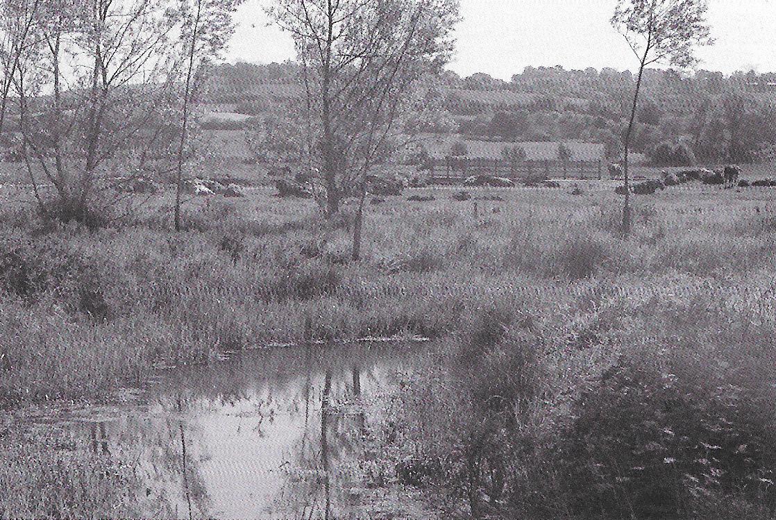
Begun in 1665 and completed by 1690 the water meadows from Salisbury to Downton covered 250 acres along a 4 mile
stretch of river. By flooding - or ‘drowning' - the land early grass growth and good crops of hay were produced allowing
more livestock to be grazed.
‘Drowners’ - the men employed to keep the channels clear - dug and operated the many hatches and structures that
allowed the water to be directed over the land. They worked closely with the shepherds and stockmen to get the very
best results from this effective but complicated exercise of field management.
This area of valley water meadow is a Site of Special Scientific Interest and there are therefore many plants,
insects, birds, fish and river creatures that make it a fascinating and peaceful part of the village landscape.
At the far side of the meadows, you pass through ‘Goose and Catherine Meads’, where there was once a ford crossing
the river. Look across to the east and the water of the Mill Leat can be glimpsed. The river has provided the power
for many mills throughout history and Downton has benefited from this source of energy for many of its industries.
On the negative side, the five rivers that flow through the Salisbury area, the Nadder, Wylye, Ebble, Bourne and Avon,
converge before Downton. As a result, this part of the river valley is one of the largest water catchment areas in the
country, and is therefore prone to occasional flooding. The large wall at the side of the river, approaching Iron Bridge,
is part of a major flood defence system built around the village after a particularly bad flood in 2000.
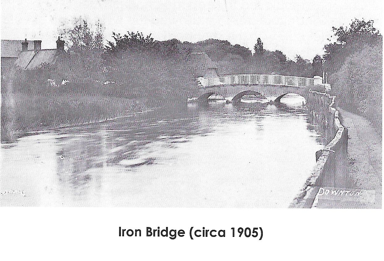
Turning left at the end of the path, the Trail now passes over Iron Bridge, also known as County or Catherine's Bridge,
a grade II listed structure dating from 1820.(It's actually a masonry bridge, the iron handrails
give the bridge it's name!)
Of the three main road bridges in the village, this is the only one that crosses the natural main River Avon. During
World War two white lines were painted in the road on the western side of the bridge, to indicate where tank traps
should be erected in the event of an invasion.
Heading east, the group of buildings on the left have at various times been used as the last venue of the village
Unionist (Conservative) Club, a drapers shop, a corn merchants, a printers and an antiques shop.
Between 2 and 3 Mill Race View is the second, less well known, ‘Bunny' in The Borough (see Plaque 3). The ditch can
still be seen on the opposite side of the road.
Former uses of some of the next set of buildings have included a flower shop, cycle dealers, wool shop and estate
agents.
The walls around the modern day garden at the eastern end of these buildings were formerly those of Mont Edsall’s
blacksmith’s shop, which was the last in operation in the village, closing in the 1970s. Barber’s and butcher’s shops
and the George and Dragon public house were once sited on the opposite side of the road. The advertisement to the right
is dated circa 1930.
The George and Dragon (now Dragon House), along with the Free and Easy (see Plaque16) was possibly closed as a result
of the activities of a Temperance Society instigated towards the end of the nineteenth century by the Earl of Radnor.
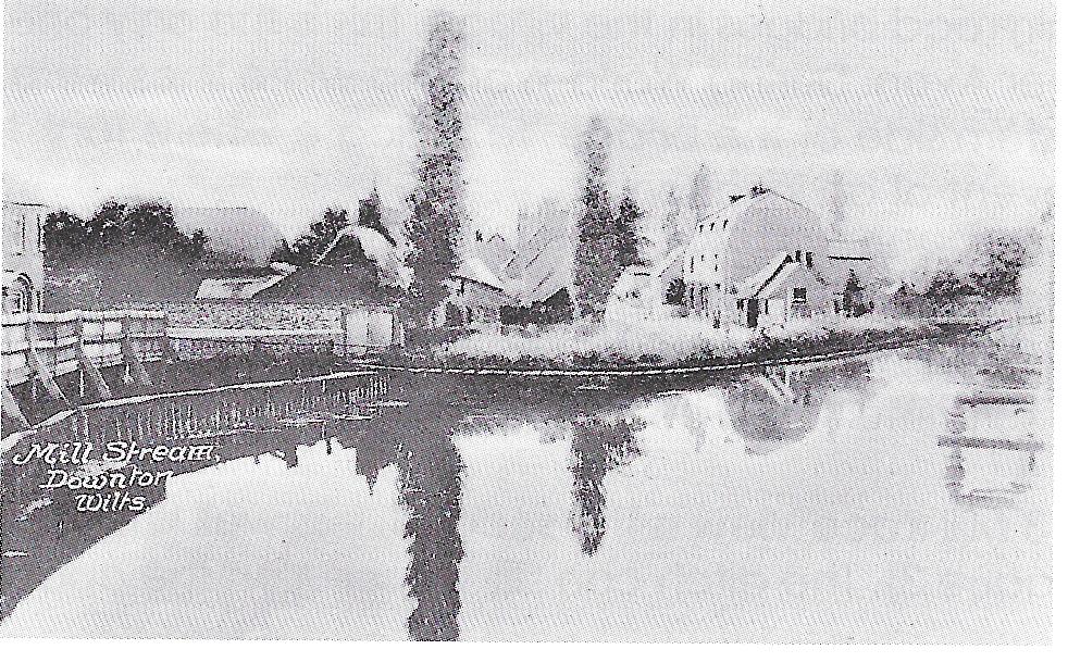
You now pass over Tannery Bridge, also known as Mill Bridge, which crosses the Downton or Wild Weir (also known as
the Mill Stream). This area is pictured below circa 1910.
A new bridge was built during 2007 and 2008. the notice board on which the Heritage trail plaque is sited was used
by the contractors for posting updates on the works in progress. Once the project was completed the board was left for
use by the Parish Council.
On the opposite side of the road there was once a basket works in the area of Casterbridge House. American officers
were billeted at the Mill House during World War Two. On returning home drunk one evening one officer started firing
his pistol in the hallway - a bullet-hole survives in the floor tiling.
The old mills, now all in residential use, are grade II listed buildings. The Bishop of Winchester owned seven mills
in Downton in 1086. The buildings remaining today were originally used as a grist mill, paper mill and corn mill.
It is likely that older fulling mills in the village were used in connection with the wool and felt trades. the
prosperity of nearby Salisbury was largely founded on wool and many of the surrounding villages, including Downton,
also benefited, as the surrounding downs were used for the grazing of sheep. Salisbury’s speciality was a striped
cloth known as a ray.
The paper mill was owned in 1781 by Joseph Jellyman and in 1843 by William Stradling. From 1885 to 1890 it was owned
by Wiggin, Teape, Carter and Barlow and then by Mark Palmer and Son, the last paper manufacturing firm in Downton, who
ceased trading in 1919. One interesting fact for the paper mill is that the first Beatrix Potter book was printed on paper made here,
The grist mill was closed in 1920 but re-opened in 1935 as a hydro-electric generating station,
operated by the Downton Electric Light Co Ltd and subsequently taken over by the British Electricity Authority (1950s)
and then the Central Electricity Generating Board (1960s). The generating station eventually closed in 1973.
A by-product that became famous and helped to support the running of the generating station was the Downton Eel.
Fish were caught in large numbers in an eel trap below the old mill, then crated up and sent to restaurants on the
London train.
There is an area of land behind the mills, known as ‘the Island’, which is said to have possibly once been the site
of a Saxon palace or villa.
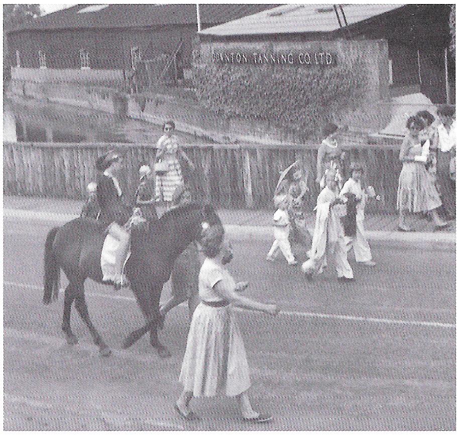
Passing around the bend, on your left appears the main old tannery building. This was erected in 1919 on the site of
the original tannery House (also known as Avon House). Prior to this the site as a whole had been known as the Tan Yard.
Downton Carnival Parade passes the old tannery Buildings (circa 1960)
The site was redeveloped in the early 21st century - the facade of the main tannery building was retained and new
flats were built behind it. All the other buildings were demolished and the Church Leat development was built in
their place. The development resulted in a sensitive treatment of the most prominent site in the entire village.
The open area between Church Leat and Church Hatch was previously known as The Square.
The access to Church Leat was formerly that to the buildings and yard area at the rear of the Tannery. There were two
shops here until the access was created, each occupied at one time or another by the village post office. One was later
occupied by 'Fishy‘ Hallet's fishmongers and fish and chip shop.
The original Downton Telephone Exchange was also located in this area and was managed by William Flake. The red
telephone kiosk sited here is a rare surviving example of a ‘K6’, designed in 1935 by Sir Giles Gilbert Scott, and
is grade II listed.
The new village library was provided as an example of ‘planning gain' provided by the developers of Church Leat.
On the first floor of the building there is always an exhibition about an aspect of Downton’s history, operated by the
Downton Museum and Archive and accessible during library opening hours. The library also holds a good range of local
interest and history books for reference purposes.
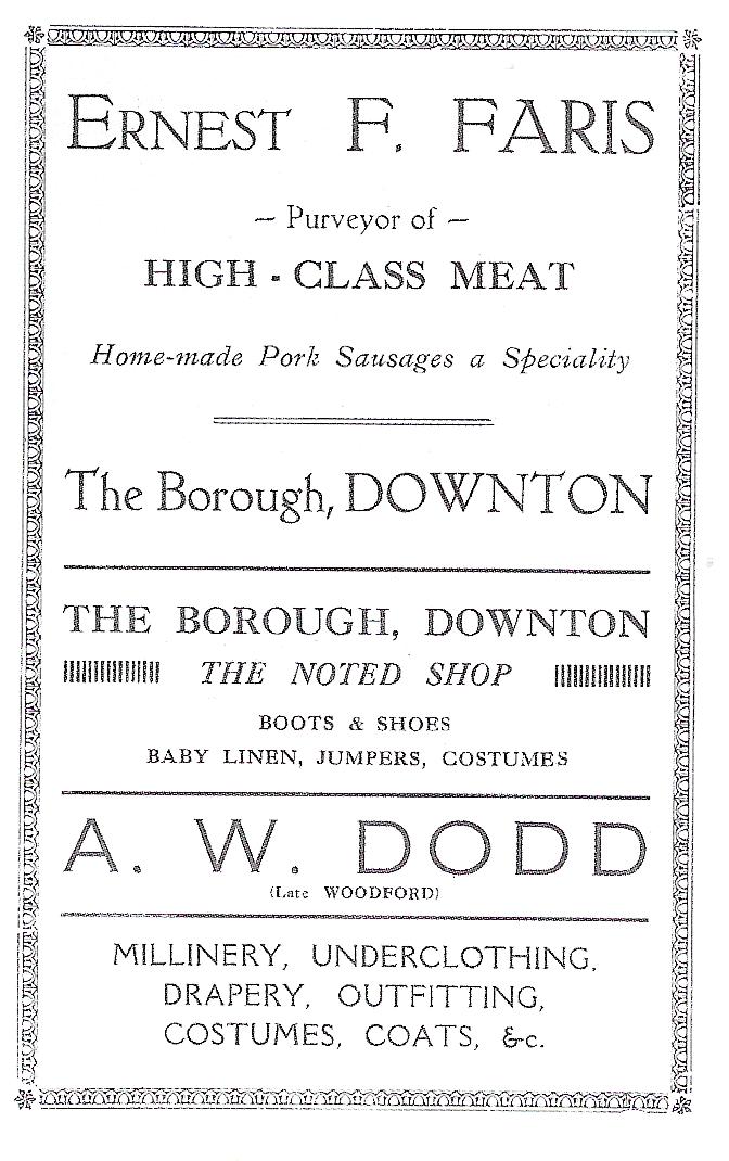
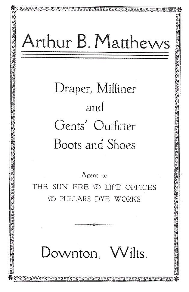
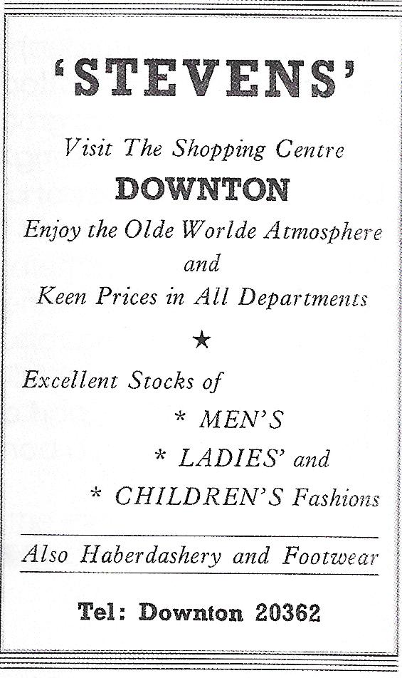
The shops leading into Church Hatch have been occupied by some famous Downton trading names, including Arthur Matthews
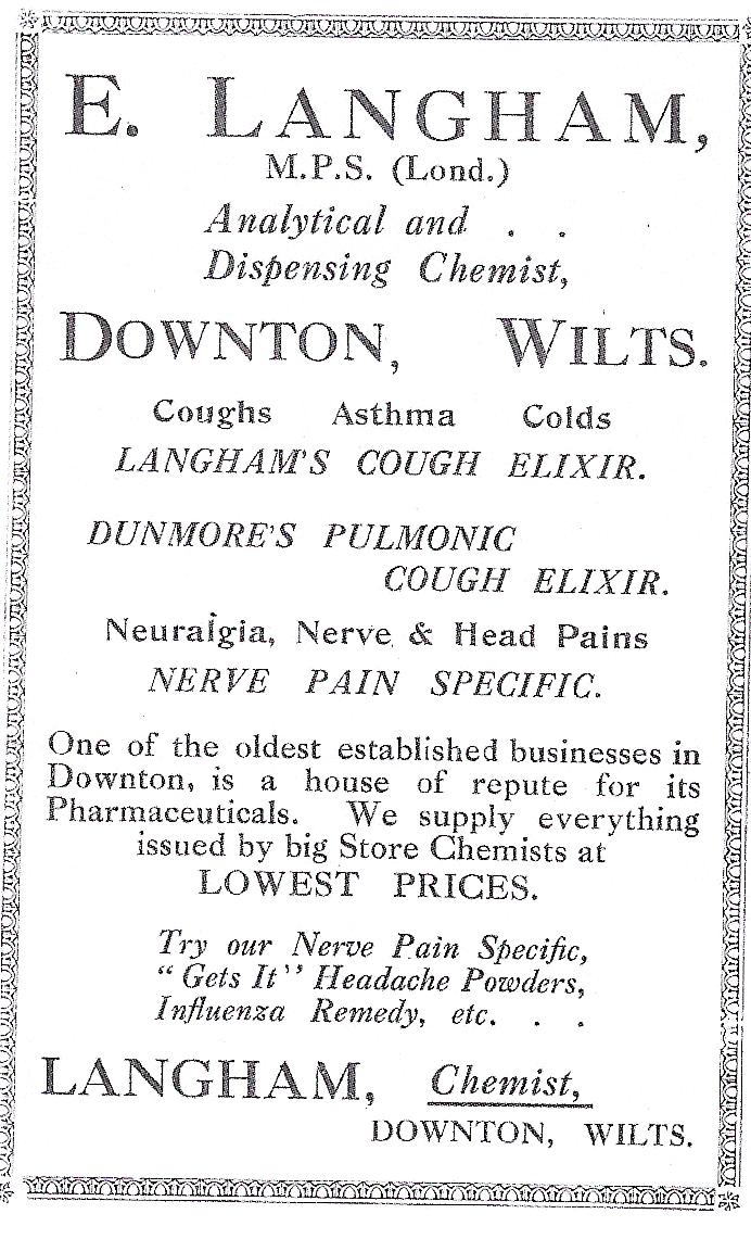
and Sydney Stevens (both drapers), and J R Bowskill (chemists). The advertisement to the right is dated circa 1930.
The Heritage Trail plaque is on the opposite side of the junction with Church Hatch in front of the grade ll listed
building dating from the 15th century. The building was the Kings Arms pub and is now converted into housing.
The end rooms of the pub building, facing towards the Old Tannery, were used as the village Reading Rooms in the
19th Century, later as the office of Clarke, Lush and Co [coal and coke merchants who kept their stores of fuel at
the railway station and more recently as a wool shop.
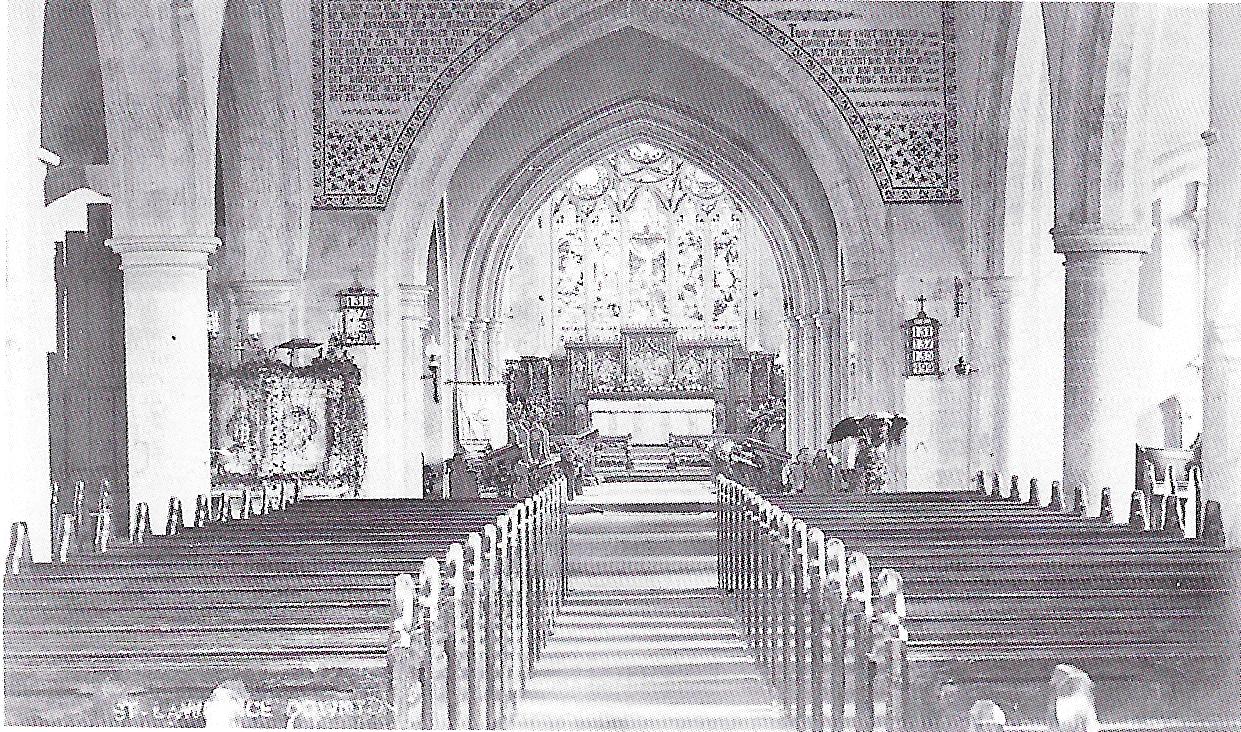
The Church of St Laurence is a grade I listed building, enjoying a prominent position on a relatively high area of
ground near the centre of the original village.
Downton was held by the Bishop of Winchester from at least the late 8th century and it is therefore likely that there
was on earlier church here. This later probably had the status of a Minster church serving the Saxon communities of
Charlton, Wick, Witherington, Walton (New Court), Standlynch and Barford, as well as villages farther afield.
A new church seems to have been built in the 12th century. In the nave the three western bays of the arcade date
from this time, when the nave appears to have been short but wide. In the early 13th century the church was greatly
enlarged by the addition of two eastern bays to the nave, a central tower and transepts, and a larger chancel. This
as high quality work and would have attracted new Burgage holders from The Borough.
In 1295 William Burnell endowed a chantry, the Chapel being dedicated to the Blessed Virgin Mary. In the early 14th
century the chancel and transept were re-modelled and raised to their present height: the aisles might also have been
rebuilt during this century. In the 15th century the western doorway was inserted in the nave and some windows were
re-modelled.
Much work was carried out in the early 17th century, including the reconstruction of the upper part of the tower and
the replacement of window tracery with mullions. In 1648 the porch was either added or rebuilt.
In 1791 the tower was raised by 30 feet (9.14 metres) to allow Lord Radnor to see it from his estate. Battlements
and pinnacles were also added. A restoration occurred in 1859-60 and the tower was then restored to its former height,
with the pinnacles and battlements being retained.
Much work was also carried out on the chancel which, until this time, had been separated from the nave by a wall,
having been used by the Bishops of Winchester as a chapel when visiting Downton. The west gallery of 1734 and the
vestry were removed at this time. Further works in 1890-9l included the replastering of the interior and new tracery
in the west window. The nave of the church is pictured below circa 1910.
In the churchyard there is a medieval cross on a raised base to the south east of the porch. There are eight bells
at the church. The oldest is dated 1605 and the most recent was added to mark the blessing of bread and wine in 1996.
On the south wall of the church a leper window and marks from a doorway where the village fire engine was once kept
can still be seen. The fire engine can now be seen in Salisbury and South Wiltshire Museum. Downton’s Reverend
Dickenson served as Senior Chaplain to the Forces during World War One. His son, Aubrey Dickenson, died on 1 July 1916
of wounds he received on that date - the first day of the Somme. By cruel coincidence, Whittaker Coombs - the son of
the village’s Baptist Minister,died on the following day of wounds received at the same battle. Their names appear
one after the other at the Memorial Hall (see plaque 3).
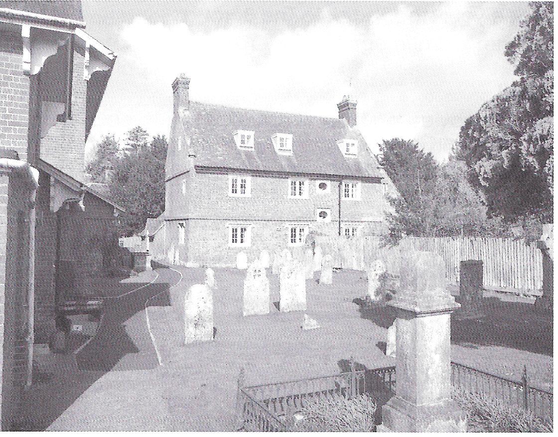
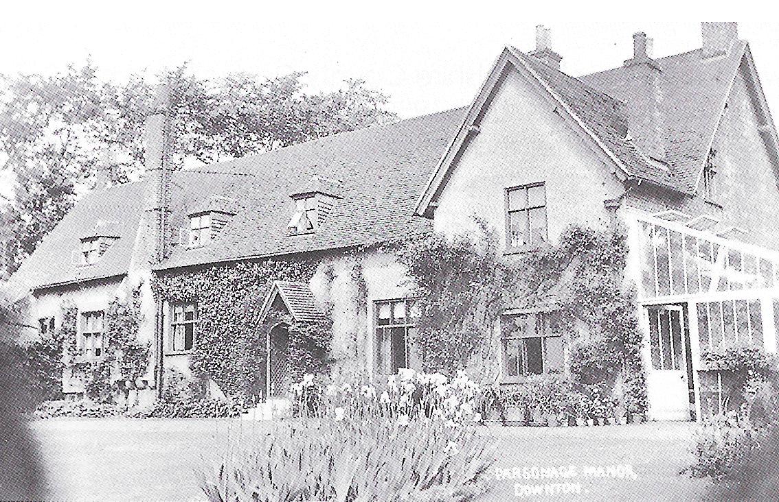
The only public view that can be had of the Manor House, another grade 1 listed building, formerly known as Parsonage
Manor, is from the northern side of the churchyard.
The Manor House is said to be the oldest continuously inhabited house in the south of England. The original house on
this site was built circa 85OAD and was used as a rectory. The building then consisted of a barn with cellars underneath,
a private chapel and a loft area where the priests slept on rushes.
There were considerable alterations in Elizabethan times, when the house and all its land were let to the Queen. She
installed John Wilkes, Secretary to Her Majesty’s Council, but he died a year later and the house was then occupied
by Sir Carew Raleigh, brother of Sir Walter.
The Raleigh family continued to use the house for almost 100 years. According to legend, in l586 they had to improve
the house at short notice for a visit by the Queen, who was on her way to visit the recently built Breamore House.
Sir Walter is said to have sailed a boat up the Avon, beached it near the tannery and used its timbers to provide
panelling and better roof beams.
A portrait of Sir Walter was hidden behind oak panelling at the house, possibly when he fell from favour. It was
found about 250 years later by the then resident farmer, who was facing bankruptcy. He gave the painting to a Salisbury
agent, Rawlence and Squarey, in lieu of a debt, and it was sold to the National Portrait Gallery for 100 Guineas (£105)
in l857. It was the first item they had actually purchased, the previous five exhibits having been donated. It is now
the best known picture of Sir Walter.
The Manor (pictured above circa 1910) was also the birthplace of Sir Roger Curtis, who commanded the gunboats at the
siege of Gibraltar. As the only son of an eminent local farmer he was under pressure to continue the family business,
but his wish to serve at sea was fulfilled and in a long and illustrious career around the turn of the 19th century
he rose to the rank of ViceAdmiral.
You should now walk along the path to the east of the church, with a cob wall on your right. This path is known as
Snail Creep, although the origins of the name are unclear.
A possible explanation is that it is taken from on old country dance of the same name, which originated in Cornwall.
The name appears in other parts of the west-country and Wales, and a path of this name is mentioned in Thomas Hardy’s
‘Under The Greenwood Tree’.
One of the wooden buildings that appear on your right is currently used as the Church Rooms (as an office and for
meetings etc). Former uses of these buildings have included the village surgery and library.
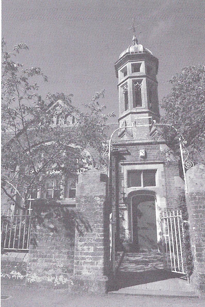
The Heritage Trail plaque is on the wall of St Laurence’s Church Hall. This building was previously used as a school -
its car park was the playground. A National Girl’s School was built here in 1830. A National Sunday and Day School was
then built here in 1846 and enlarged in 1850.
The school was taken over by Wiltshire County Council and by 1920 was known as the Church of England School. Until
1938 it remained an elementary school for all ages, up to l4 years, but after that date was used for infants and
juniors, with children aged over 11 years attending the school in Gravel Close (see Plaque 6).In 1964 all remaining
pupils were transferred to Gravel Close, and in 1975 the Barford Lane building was converted into the Church Hall.
(It has now been sold and converted to housing).
The block of garages on the opposite side of the lane was formerly used as a blacksmith‘s workshop. Further north
(beyond the Heritage Trail) is Hamilton House, another former surgery.
Properties beyond the trail on the west side of Barford Lane include Chalkhill House - a former Vicarage built in
the 17th century, the current Vicarage - built in 1975. The Manor House (see Plaque 11), Parsonage Farm, Carver
Cottages - built in 1925 for occupation by ‘financially deserving’ tenants, the Scout Field and the Roman Catholic
Church of the Good Shepherd and Our Blessed Lady Queen of Angels.
On a bend further along is a track leading to Barford Park Farm and Trafalgar Fisheries. Information about
Barford Park and
Trafalgar House can be found in the ‘Beyond The Trail’ section.
To the left of the junction of Barford Lane with the High Street is
Lode Hill, referred to as Load Hill on some
old maps. Information about this area, including the old Downton Railway Station, can also be found in the
‘Beyond the Trail‘ section. Click
here for more details on Downton Railway Station.
The beacon at the junction of Moot Lane with Lode Hill was erected in 2000 as part of the village's millennium
celebrations. The land here was cleared following the demolition of a pair of cottages to allow highway improvements
at the junction in the 1970s. The adjacent house, Moot Villa, was once occupied by a shirt maker and later the village
midwife.
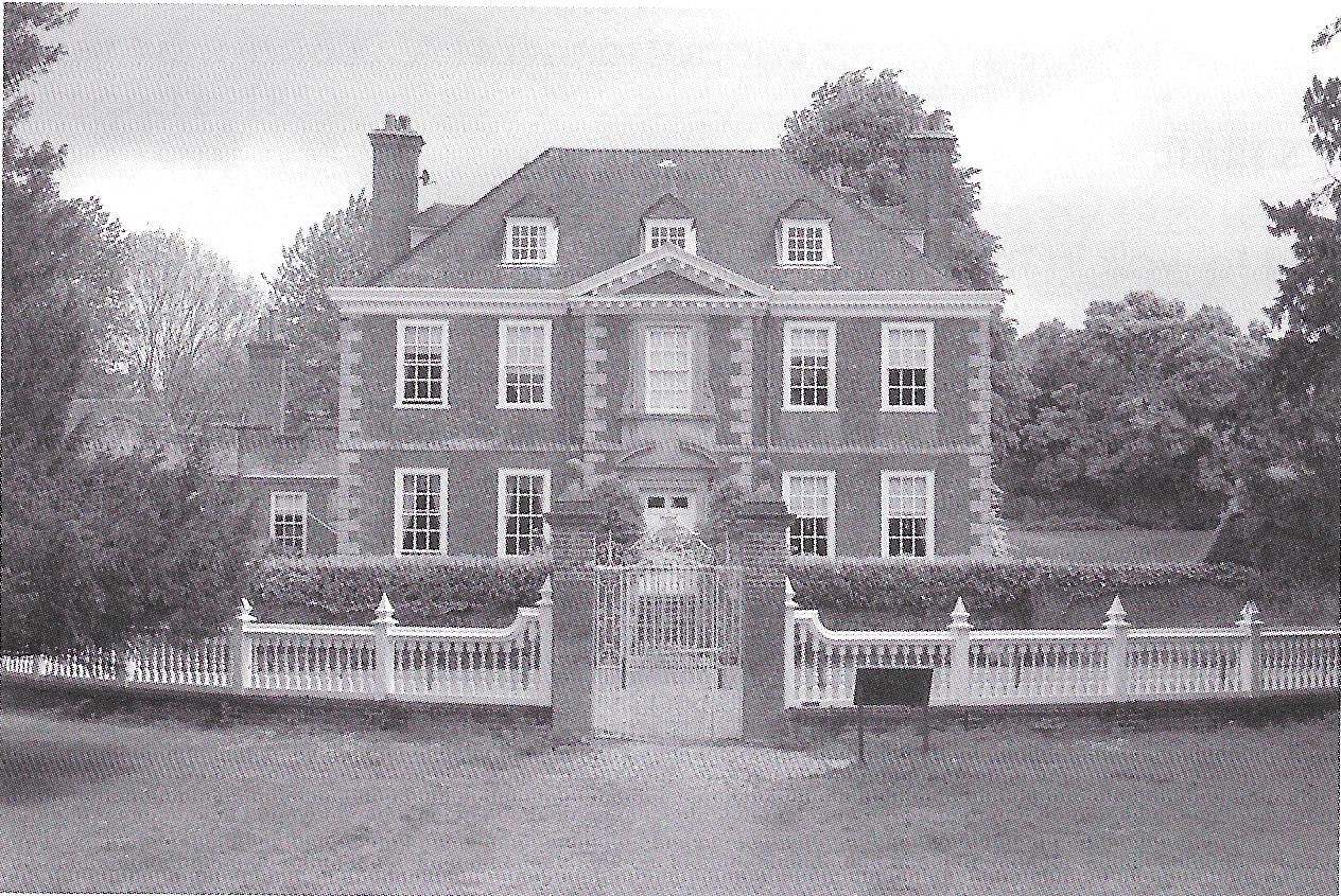
The Moot house,formerly known as Downton House, is a grade 1 listed building. the house was originally built circa
1700. However, its interior mostly dates from after 1923, when the house was gutted by a disastrous fire.
During the fire, a maid named Gwendoline Burnham jumped from an upstairs window in panic and landed on the cook,
Mrs Annie Wilson, who was fatally injured. Her ghost is said to haunt the site although, somewhat confusingly,
this spirit is sometimes said to have manifested itself as a face at the first floor window.
The Moot ornamental gardens are located opposite the house. Bishop Blois was said to have built a castle in Downton
in 1138. The Moot seems to be the most likely site, although no traces have been found so it is unlikely that any
permanent structure was built.
During late Victorian and early Edwardian summers, the Moot gardens were used for a number of fundraising fetes and
bazaars. The events lasted for up to three days at a time, special trains were laid on to and from Salisbury and up
to 3000 people attended. As well as the usual stalls, dances and fireworks, the events also included open-air
performances of Shakespeare plays. Sybil Thorndike played Adriana in ‘A Comedy Of Errors’ here in 1908.
The Moot is a Scheduled Ancient Monument and is now owned and managed by a charitable company. The administration
and much of the maintenance of the site is carried out by volunteers. Click here for more information.
Immediately beyond the gardens are the current village surgery and a recreation ground. Until the 1950s there had
been very little development in Moot Lane beyond this point and Moot Farm, on the opposite side of the road. The
lane had been lined with high banks and chestnut trees but improvements in methods of water supply meant that this
relatively high and hard, chalky ground away from the river could now be built upon.
The area where council housing was built in Castle Meadow had in fact been where the first known Downton people lived.
Beaker, Neolithic and Mesolithic items were found here during archaeological surveys in 1956 and 1957. Saxon and
Medieval features were also found in the area during further excavations in 1962.
In 1953, on the opposite side of Moot Lane, part of the tessellated floor of a Roman villa was discovered by the
occupier of a newly built property in Moot Close, who was apparently digging a hole for a new washing line post.
Mr Morley-Hewitt of Fordingbridge, who had connections with the site of the villa at Rockbourne,carried out
investigative works and, during 1955 and 1956, the Ministry of Public Building and Works excavated the remainder
of the site.
Although part of the original site was inaccessible due to the railway to the east,the excavations covered most
of the rear gardens from 5 to 12 Moot Close. Part of the floor of the villa can now be seen in the Salisbury and
South Wiltshire Museum.
Just beyond the southern end of the now built-up part of Moot Lane, Pile Bridge carried the old railway line across
the River Avon. Further information on the rail disaster that happened here in l884 can be found in the ‘
Beyond the Trail' section, along with information about the
Millennium Green and
Downton Brickyard, also along Moot Lane.
Returning from Moot Lane and turning left into the High Street, most of the buildings you can see are listed.
On the opposite side of the junction, the house at the corner of the High Street with Barford Lane was formerly used
as a registry office and was the last property in the village that remained in the ownership of Winchester College.-
The Wooden Spoon public house was formerly known as The New Inn and briefly,The Downton Inn. Other buildings of
particular interest on this side of the street include number l9 [Harebell Cottage), formerly occupied by Walter
Durdle, a shoemaker who was also a church sexton and the last engineer at the old Downton Fire Brigade; number 15
(The Warren) , where the Heritage Trail plaque is located - formerly used as a Vicarage and said to have once had
an underground passage to the church; and number 13, formerly known as Inverness and once occupied by John Reeves,
a licensed maltster whose sign can still be seen on the front wall. (The Warren was also
the home of Professor Wrightson - the great grand-father of Lord Julian Fellowes, the creator of the Downton Abbey
TV series - he named the program after this Downton, and "Abbey" after Ramsey Abbey in Huntingdonshire).
Of interest passing along the southern side of the High Street are numbers 32/34 - formerly Arthur Chipperfield's
grocers shop (which lives on in the modern house name) and the old Downton Post Office (formerly Eastman's Wicker Repository).
The modern day Methodist chapel was built in 1896. After the closure of the New Wesleyan Reformed Chapel (see next
page) and on amalgamation with local Primitive Methodists in 1932, the Wesleyan Methodist chapel became the United
Free Methodist church. and has recently been sold and is being converted into housing.
Former members of the congregation of the Wesleyan Chapel on Lode Hill (see the ‘Beyond The Trail‘ section) were
apparently meeting in two cottages on this site from l884. The cottages were owned by the headmaster of the British
School and on his death he left them to the Wesleyan Methodists.
Number 18 (Ravenswood) is another building that was once partly used as a grocer‘s Shop. In 2007 the adjacent
building, then occupied by the Mace Downton Village Stores, was gutted by a fire, footage of which subsequently
appeared on YouTube. The premises had previously been operated by Woodford & C0. International Stores, Bailey and
son, and Spar.
Number 14 was bequeathed to St Laurence's Church in 1914. by Elizabeth Baily Hooper, to be used as ‘a residence for
a female Lay Reader of the Church of England for the benefit of Downton'. It had been named The Laurels but following
the bequest was renamed Church House. It remained in the ownership of the church until i955. During World War One
the house was used to accommodate the Deflours, a family of Belgian refugees.
Avon House and the adjoining fish and chip shop were once a hardware shop operated by Oswald Coppack and Sons and
then Mr Lamont. The modern day Tannery House was briefly used as an alternative health centre in the early 21st century.
The original Tannery House was located on the opposite side of the road, where the old Tannery building itself
now stands.
As its name suggests, Chapel Cottage was constructed on the site of a now demolished chapel. A group broke away from
the Wesleyan Methodist chapel in Lode Hill in 1849 and opened their own New Wesleyan Reformed Chapel here between 1851
and 1854. The chapel was still open in l900 but appears to have closed a few years later.
The chapel building was later used as a youth club, operated by local teachers Mr and Mrs Holgate and known as ‘The
Be Bop'. The legendary Johnny Holgate and The Woodworms played here, as did The Riverside Skiffle Group who later
went electric and became The Aces. These bands then provided members for the most celebrated band in the Downton
area - The Satellites.
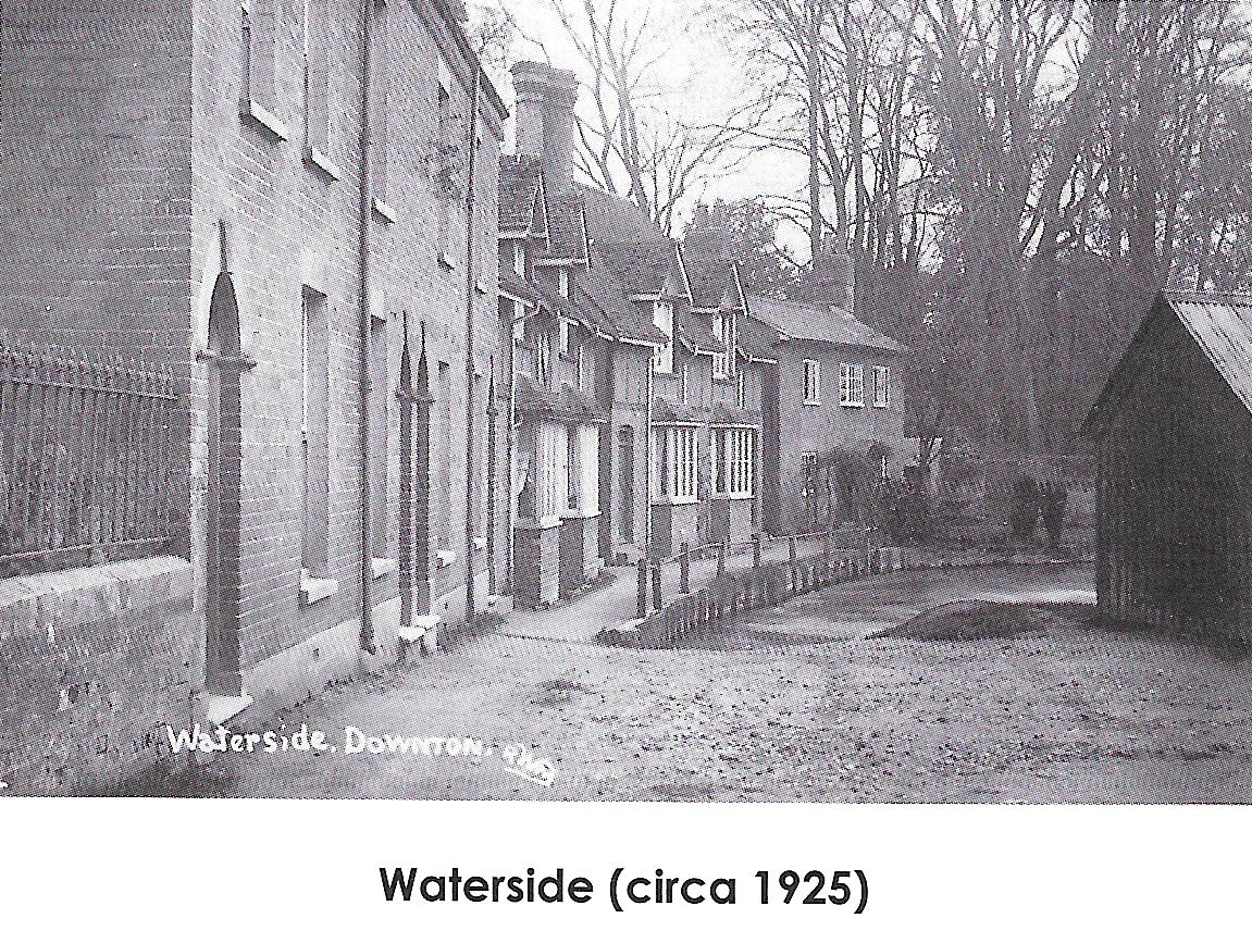
Waterside is primarily included on the Heritage Trail for its great views along the river. However, if you turn
around slowly at its entrance you can see the Mills, The Borough, the old Tannery, the Church, the High Street and the rear of the Moot
gardens.
The will of eccentric surgeon Thomas Sheffield requested that on his death he should be buried in the garden of his
house, near Waterside, and that his favourite horse should eventually be buried with him. In 1807 his body was
exhumed and reburied with that of his wife in the churchyard. During more recent excavations in the area, the
complete skeleton of a horse was found ..…
The Natanbury cottages were built in t905. They are supposedly named after the legend that the 5th/6th century
British King Natan is buried nearby. At the end of Waterside is Moot Cottage, originally built for the gardener
of the Moot.
On leaving Waterside, you should cross the road to return over Tannery Bridge and on to The Borough.
Having re-crossed Iron Bridge, to your right is a group of dwellings that have previously had other uses.
The part of 103 The Borough (Creel Cottage) nearest the river was formerly the Iron Bridge Basket Works, established i
n 1801 by Mr Eastman. At that date it was purely a basket works but 50 years later the company produced its first
wicker chair. The American Eastman family, of Kodak Film fame, is descended from Downton Eastmans. The building has
the only surviving example of a painted Burgage number.
101 The Borough (Borough House) was formerly used as one of Sid Stevens’ drapery shops. The old shopfront can now
be seen in the Breamore Countryside Museum. the small annexe to 99 The Borough was converted from the former National
Westminster Bank building. The advertisements to the right and on the following page are dated circa l975.
The Heritage Trail plaque is located at the front of the Old Granary, converted to residential use in around 1990.
Former occupiers of the site included Hardings grain merchants, Hickman Brothers corn, cattle food and fertilizer
merchants, Critchcraft and Logan Homecare.
Next to the Old Granary is the access to Green Lane. Although it appears to be quiet residential stret, Green Lane was almost
a small industrial estate at the beginning of the 20th century. The large building next to the access, together with the land
on which the houses in the lane are sited, was last occupied by the Chemical Pipe and Vessel Company,although there
had previously been a row of cottages to the rear forming the original Green Lane.
The surviving building was originally the village workhouse and gaol, built in about 1730. Adjoining the workhouse
was the smallpox house. The building was also later occupied by Downton Home Industries, the Unionist (Conservative)
Club and the South Wilts Bacon Curing Company.The land behind the workhouse was the old Downton gas works run by the Downton
Petrol Air Gas Company.
Downton Home Industries was founded in l90l by Mrs Plumtree and Mrs Robinson, under the patronage of the Countess of
Radnor, primarily to organise local lacemakers and other craft workers info a more professional unit. It is not known
exactly when lace making started in Downton, but it continued as an ‘industry’ until 1966, although by then it had
moved back into the cottages. The Salisbury and South Wiltshire Museum has an excellent display of Downton lace.
Although several examples of artisan thatched cottages have been demolished over the past century, a number of
listed buildings and other properties of interest remain in this part of The Borough. On the northern side of the
first green, between the Old Granary and Moulds Bridge are the following:
Horsehoe Court was formerly the Three Horseshoes, a public house,which was converted into flats in around 1990.
Next to the old pub, at 83 The Borough, a new house has been built on the site of Mr Miles’ legendary ‘shell house’.
During the l960s and l970s coach parties of tourists visiting the New Forest and Salisbury would make a special
excursion to view the model village he had created out of broken tiles, pottery and crockery. Remnants can still
be seen on the boundary walls of the property.
79 The Borough (Hurdles) was formerly the Free and Easy public house and a grocer’s shop.
The Barber Shop (previously the Cottage Loaf baker’s shop) was formerly occupied by Ernest
Street’s ironmongers, grocers and provisions shop and the Halifax Building
Society. The Free and Easy, along with the George and Dragon was possibly closed as a result of the activities
of a Temperance Society (see Plaque 8).
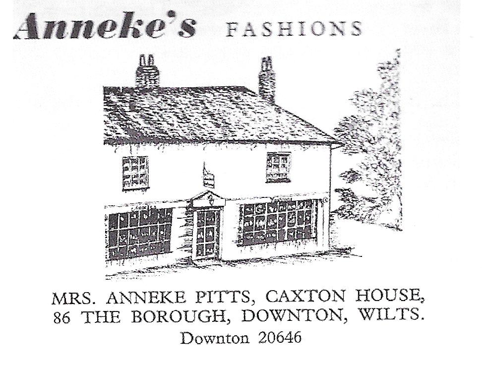
Returning to the southern side, 86 The Borough (Caxton House) was formerly used by an estate agent, Anneke’s
Fashions and a baker’s shop. Cottages and a set of advertising hoardings once occupied the area of 78 to 84 The
Borough, while 76 The Borough (Herons Walk) was built on the site of the former Army Cadet Hut. In November 1918,
as part of the village's Armistice celebrations, an effigy of the Kaiser was burnt on a bonfire in the meadow on
this site.
The large Borough Greens, used for fairs right up to the modern day, are leased by the Longford Estate to Downton
Parish Council for a peppercorn rent, for the general benefit of the village.
The Heritage Trail plaque is located on Moulds Bridge, also formerly known as Kingston Bridge, which crosses the
Newcourt Carrier (see plaque 7). A cottage with Burgage rights was demolished to accommodate the carrier, but the
land retained these rights. A modern replica of the Burgage stone can be seen in the wall at the east of the northern
side of the bridge. Land to the east of Moulds Bridge was used as a tan yard during the 18th century.
On the northern side of The Borough, between Moulds Bridge and Gravel Close is a row of shop premises built on the
former site of a row of thatched cottages. The bricked up fireplace of one of the cottages - which had been occupied
by Fanny Pretty - can be seen in the end wall of 51 The Borough (Cymbeline), to the left of the forecourt of the
shops. Number 51 also has a Victorian letter box in its wall and was formerly partly used as a shop belonging to Mr
and Mrs Newman, who also ran a café on the site of the modern houses at 49A and 49B The Borough.
Returning to the southern side, 70 (Leicester House) and 72 (The Borough Cafe - which had been Lloyds TSB Bank)
had previously been Hill’s
chemist shop with photography studios. Medieval coins, tiles and wattle and daub have been uncovered during
previous internal works of Leicester House.
The Co-operative Foodstore was rebuilt in the 1960s on the site of a shop previously occupied by Mitchell and
Baker’s grain merchants. The access to the car park at the rear was the site of a now demolished cottage.
The Goat (previously The White Horse), together with the adjacent shop, is a Grade II*
listed building. The first hostel, or inn, in Downton is mentioned in 1503 and this was possibly this building,
the earliest parts of which date from the 15th Century. The White Horse was
first recorded by name in 1599.
Tradition has it that the busts sited within the niches at the first floor of the White Horse are of King John and
Queen Isabella. this is now thought unlikely by experts, although King John is believed to have visited his supporter,
Bishop Peter de Roches of Winchester, whilst the latter was in Downton, as is an earlier king, Stephen, whose brother,
Henry of Blois, was the then bishop.
Whether or not you have already sampled the hospitality of the other three pubs in the village, all of which are on
the Heritage trail, you might care to treat The Goat as a ‘l9th Hole’ (or perhaps ‘l8th Plaque'), while reading
about some of the outlying parts of the village in our final chapter. Look out for the old photographs of Downton
dotted around the interior.